I’d done a bit of bike touring but absolutely none on trails. Unless you count that time I got REALLY lost and had to throw my bike over a hedge and cycle across a field to get away from THAT swan. Totally counts, right?
I’d planned to ride with a friend I’d known for years, Abi. We'd done an 80 mile ride earlier in the year to see if we could cope with being together for hours. We’d survived, no-one had tried beating the other to death for too much talking and she hadn’t asked to share my snacks. Perfect.
Abi had taken her bike in for a service at her local bike shop and had mentioned she was doing King Alfred’s Way. The chap in the shop had mentioned it was a tough trail … and then stared away into the distance as though he was re-living bad memories. As though he was remembering having to wild camp and the food had run out and everyone had turned feral and they’d had to eat Steve. Hmmm. Abi didn’t ask about his memories of the trip. Although she did consider inviting HER mate Steve. You know, in case things got really bad.
Despite hearing about tough trails, I'd decided against taking my mountain bike. It's 20+ years old and held together with spit and good will. Instead, I decided to take my road bike but put some chunky tyres on. Well … as chunky as you can get with limited clearance and disc brakes. So not very chunky.
Meh … it'll be fine. I hope.
I'd booked a hotel for the night before so we could make an early start but the room smelled so strongly of weed that I'd had had to move rooms in fear of getting the munchies off someone else’s high and eating all the snacks I’d packed for the entire trip.
It'll be fine.
DAY 1
I met Abi at 0800hrs at old Sarum, which is an old iron age hill fort and I'd parked over the road for free. My car is an ancient and very rusty Skoda which looks as though it's on its last legs (wheels?) so it's practically theft-proof as it definitely doesn't look as though it'll start with a key, let alone for a thief chancing his luck.
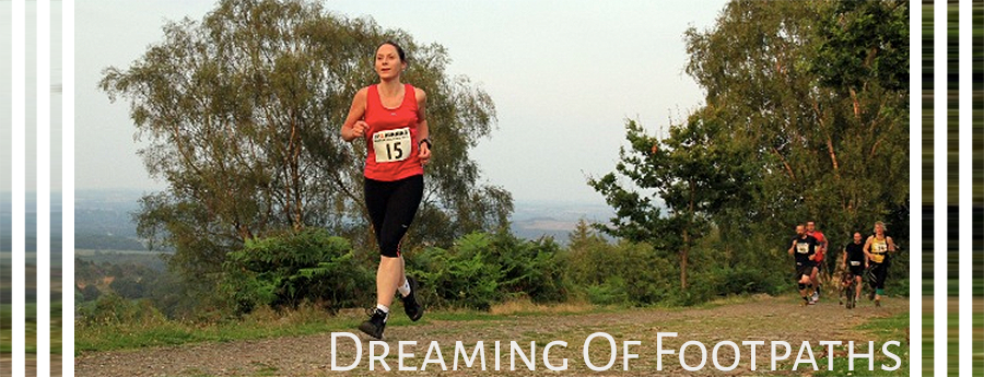
Full of enthusiasm, caffeine and sugar, we powered up the short sharp hill to Old Sarum and with a quick stop for a start photo, we were through the gate and on our way!
The first trails were mainly grass and dirt and chalk with sharp, shiny flint pieces. They were very rolling and much rougher than I’d expected and there were stretches of everything from sticky mud to sharp flint to long grass to chalk to pebbles and gravel. All within the first few miles. It was definitely going to be a challenge … even with the 'chunky' tyres.
However, everything is better under blue skies and with spring flowers in the banks and hedges and the sun threatening to shine, it was a good day for an adventure. The first bluebells were out and so was the wildlife. We saw red deer standing in the fields as we passed and even spotted a couple of hares bounding away from us, their angular forms and dark tipped ears making them distinctive.
The trails gave way to a section on the road and we passed a ‘Stonehenge World Heritage Site’ sign. I was hoping to get a close view of the standing stones. However, we went towards Larkhill Camp rather than across the plains which gave us a view of Stonehenge we didn’t usually see, from the other side across the fields. I didn’t notice the stones at first, just the long line of campervans along the field edge marking the tourists hoping to avoid the parking charges.
Following the road, we came into Larkhill Camp and as we passed by the distinctive services houses, I saw the first swallows of summer soaring over the hedges, silhouetted against the bright sky. It’s official! Summer is really on its way.
A brief section of tarmac and back onto trails. It was tough going on these trails as they were single track and rutted and lumpy. The bike bumped and rattled, but the weather had been quite dry recently and I was very grateful for that. This could have been a lot tougher if it had been a damp spring.
We chatted as we went and followed the route across acres of fields. The trails were mainly rutted and grassy, but there wasn't very much of it that was flat. The hills were rolling chalk downs with the trails following the hills and valleys. Abi asked how far we’d gone and I checked the watch. We'd been cycling for around 2 hours and not even covered 10 miles. Cycling trails was certainly going to be very different to the road cycling I was used to. I just had to hope there was about the same amount of cake. (lots)
I was following the route on my Garmin watch which has fairly decent maps on. I’d plotted and uploaded the route and the watch directed us well, even on the tiny byways and bridleways which might have been difficult to spot otherwise.
We were directed straight ahead at a crossroads, but I stopped at the junction as there was a big sign saying ‘Road Closed After Bustard Inn’. I couldn’t find Bustard Inn on my map so I wasn’t sure whether we'd get to our byway before the road closure. A cyclist coming the other way stopped when he saw me checking my route. He promptly told me I couldn’t go down this road as there was a red flag by it. There was indeed a red flag, but we were planning on staying on the road which according to the sign was still open until the Inn. I thanked him for his (unsolicited) advice upon which he repeated it again. Twice. He then cycled off, into the undergrowth past the red flag.
Okey-dokey, then.
Abi and I decided we’d follow the road as far as the Bustard Inn and then re-assess if we hadn’t turned off before then. We got pedalling and were passed by an army vehicle who waved but didn’t re-direct us.
Ok, that’s promising at least.
We followed the road for a mile or so seeing no sign of the aforementioned inn and got to a dusty 5-way crossroads. It helpfully had a signpost on which had a byway sign on it. Unhelpfully, the sign had broken off and lay at the bottom of the post. There was no clue as to which direction it had originally pointed.
Bugger.
Our Garmin route seemed to point to the first exit which had a big red sign on it saying ‘Road Ahead closed. All MOD vehicles use STR’. Did that mean we could use STR too or just military vehicles. And did that mean it was closed just to vehicles or did it include bicycles? And what did STR mean? A sign just behind it said ‘Road out of bounds to all military traffic.’ We weren’t military – did that mean we could use it? It was the most confusing set of signs. I was a bit concerned by the red flag too – I definitely didn’t want to stray onto a site which was being used for live firing.
There were a few military vehicles around which didn’t seem concerned by our presence and quite happily waved as they passed. We wanted to check though and flagged down a vehicle which had brown camo on it and a couple of soldiers in it. The soldier confirmed that the red flags were only if we went into the undergrowth beyond the flag; the roads and byways were quite safe.
Phew! We weren’t convinced about the ‘Road Closed’ road though so went along the STR road (whatever that meant) but we could see it was open, and just beyond that we spotted the byway sign. Hooray! We crossed the grass following the byway trail and it popped us out onto a dusty road. We followed this for a mile or so, occasionally being passed by military vehicles. We coasted down a hill just about to turn off to the left onto the byway we could see on the map when we were flagged down by a portly gent with a neck tattoo and orange lights on his vehicle.
We stopped, of course, whereupon he explained that we were doing something very illegal and had passed multiple stop signs. (Which of course we hadn’t) We explained that we were of course terribly sorry and had even checked with someone that we were ok to be on this road and were about to turn left onto the next byway. The gent told us that in his opinion the byway we should go on was a completely different one going in the opposite direction to the one were about to take. He got out his maps to show us, which were of course highly official and only available from the army. I tried to explain that I could see where we were going and were of course terribly sorry to have come down a road we shouldn’t have but we were explained to that we should go in this direction on this byway to somewhere completely random. Rather than down the byway we needed that went to the place we wanted to go.
We went round in circles for a bit but in the end I thanked him for his kind advice, but we really did want to go the direction on my map and were very sorry for any inconvenience and thanked him for the look at his very official maps and carried on, onto the byway.
We crossed a busy road and were back onto the dusty, chalky trails. We had a couple of miles on grass which was lovely cycling – hardly any ruts and it was dry and hard. Lovely! Back onto chalky trails soon enough, miles and miles of them and I wondered if Dad had biked over these. He had been mad about his off-road motorbike and had loved going out to Salisbury plain with his friends for some trails.
I found that much as I was enjoying the chalky and occasionally muddy trails, I seemed to be going slower and slower and my bike was making some odd noises. I stopped to wait for Abi and realised I didn’t need any braking at all to stop. And that there was a bit of mud on my bike. Blocking up my brakes specifically. Well that explained the odd noises and the lack of braking required on the downhills. I was doing some resistance training without realising it as the mud was stopping the wheels going round. There was nothing around to get the mud out, no sticks, just grass, chalk and flint. I picked up a spiky flint and started trying to dig out the mud so the wheels would move. It was about as successful as it sounds. But I created a bit of a gap so the wheels could go round again.

The trails alternated between chalky and flinty and grassy and dirt trails. There wasn’t a great deal of flat, we were ether going up or down and it was much harder riding on the trails than on the roads. Every time we got to a junction and had to check the direction, the route we’d be sent always seemed to be the uphill fork. Of course it was.
But then … no PROPER adventure starts with “Well … every thing was super-easy ...”
Occasionally we’d see a nice smooth trail or bit of road … and then we’d see the tiny bridleway or byway tucked behind it. And of course we were going the interesting way. Read: Tougher way. But we were doing this because it was a challenge, not because it was easy. I rode on the roads all the time, this was so, so different. And because it was slower, I had the chance to look at the views and at the flowers and spot the hares running across the fields and playing or the deer jumping through the yellow rapeseed flowers. It was a completely different experience.
We had a long old hill on broken roads coming up from Gore Cross. It was very damaged and rutted, but the views were of fields, green as far as the eye could see with the verges dotted with bright yellow dandelions.
We cycled along the ridge for a while until we popped out by a WWI toposcope on a plinth by Lavington & District showing all the landmarks you could see from the top of the hill. Apparently you could see for over 15 miles in some directions. We had a good look and hopped back onto the ridge for some gravelly trails. The ploughed fields were a bright cream colour from all the chalk in the soil.
We dropped down from the chalky ridge and back into the loamy mud. Luckily we were under trees for this sections so a couple of stops to unstick the wheels and brakes meant there were sticks available to poke the mud out. When we dropped into the valleys, because of the tiny tracks we were on, we encountered a few tractors and could certainly tell where they’d been with their large wheels churning up the tracks and laying the mud on the lanes. It made for some trickier cycling as not only were the ruts deep but the tread on the tractor tyres made it a bumpy ride.
We had been hoping to see a little shop or petrol station for a while as there hadn’t been as many opportunities to refill water bottles as we’d hoped. Coming into the little village of Chirton, I checked a map and we saw a garden centre & nursery marked. Delighted we cycled up to it hoping for cake and coffee as well, just to see a closed barn which must have sold farm supplies at some point.
We stopped at the church to use the outside tap as there is usually one for the flowers. The church door was open so I walked up to ask permission, but the vicar was halfway through a christening so I walked around the church but couldn’t see a tap. We carried on through the village and passed a man and a small boy with a bike outside their house so, assuming they were cyclist-friendly, I stopped and asked whether they
would mind refilling our water bottles. They kindly did.
We had a nice ride across the chalky, dusty roads up to Tan Hill near Allington. It has a gate halfway up so took a cheeky view pic as I stopped to open it to get the bike through (didn’t dare try the cattle grid while going slowly on fully-packed bike up a hill!) and then carried on to the top where the road curved around the hill. There was not the view I was hoping for … it had all been behind me as I cycled. Never mind, I put the bike down and had a snack while I waited for Abi to finish climbing the hill. Apparently Tan Hill is the second highest of the North Wessex Downs being just 26cm less than Milk Hill which is the taller one. According to the map we did also go up Milk Hill which has a white horse carved on it's side but I didn't see this. Probably dreaming about my next snack ...
We had lunch at Red Lion in Avebury. It was an an old stone pub, surrounded by ancient standing stones and because it was the weekend of the 1st of May, there were lots of very happy, dressed up and drunk druids celebrating the MayDay Festival. There was a singalong going on in the courtyard and the atmosphere was friendly and cheerful. The whole place – busy as it was with people – had a really lovely feel to it. The pub was very busy because of the celebrations but we got a cosy table indoors where we could see the bikes and I scoffed down a chicken BLT and chips. Perfect.
There was a well inside the pub with a glass plate across it with the inscription ‘Village well circa 1600, 86ft and believed to be the last resting place of at least one unfortunate villager’. I didn't spot any pale villager ghosts drifting through the pub just us two pale cyclists although Abi had managed a start on her cycling tan by forgetting her sun screen. She had a particularly distinctive elbow tan which was white and red stripes. Very fetching.
We stopped for a couple of pics by the stones - and a traffic cone for some reason - and set off onto our next trails. The sky was getting darker and more ominous and views
across the hills showed rain coming down. We passed several spots where the road was wet and puddly but managed to avoid getting rained on.
We joined the Ridgeway at around Marlborough and I took a quick snap of the bike against the signpost while I was stopped. The Ridgeway was mainly grassy and stony trails, lovely riding although it got quite rough in some parts. I wasn’t sure whether to ride in the ruts - and hit the pedals on the sides or on the smoother top of the rut in the middle - which would often end in an enormous puddle or on the grassy verges - which involved the occasional trips into the prickly hedges when the verge ran out. I compromised by doing a combination of all 3 and trying to avoid prickly hedges. Worked mostly. There was a certain amount of prickle extraction.
Coming along the Ridgeway, we spotted a lone cycling shoe in the middle of one of the trails. There was no-one else around for miles. Just one lone silver cycling shoe. Couldn’t quite work out how it got there. Maybe it had all gone to hell and they’d eaten Steve.
I was enjoying the cycling. There was much more trail than I’d expected even after plotting the route for each day and some very tasty hills that just kept on going. It’s definitely a route if you like a hill or two or a hundred. And some really quite challenging trails. An odd thing though, on some of the worst and roughest trails there would occasionally be a random cats eye road marking. It would be just the one and it would be stuck up at a weird angle or at the edge of the path, very out of place. It was kind of like finding a sprout in your ice cream. No idea why it’s there, it’s no use to anyone and you couldn’t believe anyone would think it was a good idea.
We passed a lot of land forts similar to Old Sarum such as Segsbury Camp. I genuinely had no idea there were so many in the UK, let alone in this small area. If we saw a land fort in the distance, the trail seemed to head for it. You could almost guarantee there would be excellent views from the top as they were planned in areas of strategic importance and usually you could see for miles from the top of them. The only problem was getting to them as the sides were usually fairly sheer and flinty or muddy which made for hard cycling.
After cycling miles of tough, rough trails, I couldn’t get my bike up the steep, flinty hill at the Barbury castle fort as the back wheel kept sliding out on the mud. I blamed it on the path underfoot and pushed the bike up. I was happy that rather than the mucky trails and skinny tyres on a fully laden bike, the reason I couldn’t get up it was down to the terrain rather than being knackered. 70 miles of trails felt a long way but my legs weren’t done yet!
We saw a few other laden bikes on the route although it was difficult to tell whether they were doing King Alfred’s Way too or out on completely different adventures. There were a lot of trails in this area and we were exploring just the one route this weekend. Pretty much every group I saw commented on the skinny tyres … they were a compromise. Let’s hope they aren't a horrible lesson.
We passed a sign saying Hackpen Hill which surprised me. I’d cycled up this on the road on my very first sportive and I’d remembered it as an awful hill, but we’d approached it from a different direction on the trails and it hadn’t been half as terrible as I’d remembered. We were cycling the section from Overton Hill to Sparsholt Firs now along the Ridgeway and it was lovely wide gravel roads and grassy fields. It was a lovely rolling route and in the late afternoon sunshine, it was peaceful and beautiful. The views across the hills and valleys were incredible.
We had a long old climb up a gravelly hill at Ogbourne St George and the Garmin beeped to tell me it only had 10% battery left. Bugger. I’d been so busy chatting at lunchtime and watching all the May Day celebrations, I’d forgotten to give it a quick blitz on the battery pack. I got to the crossroads at the top of the hill and laid the bike down and got the charger out while waiting for Abi. The Garmin charges really fast which is a definite benefit - it was at 20% after a few minutes and we got back on the bikes and continued along the ridges.
The light was fading now, but it gave everything a fairytale, ethereal light. The only noises were the whirr of the wheels and the tweeting of the birds.
At the crossroads at the top of one of the hills was an animal trough with a water tap above it and sign saying it was drinking water. I gratefully filled my water bottle while I waited for Abi. Riding together worked well, I could quite happily ride the uphills and flats all day but was more cautious on the downhills on the skinny tyres, whereas Abi on her wider mountain bike tyres could quite happily bomb down the hills. It worked well, I’d go ahead on flats and uphills and then wait for Abi and move out of her way so she could zoom down the hills.
I also finished off the day’s snacks. I’d packed a couple of bars but the majority of my snacks were pick’n’mix. I love a bit of sugar when I’m cycling and pick’n’mix had seen me well through all my summer 100 milers last year. Any excuse to eat sweeties, really.
On one of the trails, we passed a sign for Waylands Smithy. We turned off the trail and under the trees and found the barrow with large stones. It was very serene under the trees. We were the only ones there and it was a very still evening. I took some photos and the light was just beautiful. I felt very lucky to have seen it like this.
We zipped down the trails in the dusky light and went past a kid lying on the bonnet of his car, not expecting anyone to come past. In the middle of nowhere enjoying the evening sunshine.
We continued along the trail along the ridges and while it was hilly, we weren’t going crosswise over the hills, like it felt we were at Salisbury Plains so it was easier riding despite the roots and stones. We passed a random camper van which had been turned into a permanent house with tarpaulins covering the roof and lean-tos around it.
On one of the grassy sections, surrounded by rapeseed flowers, I waited at a trail junction for Abi and saw 2 men wild camping. I was in a position where I could see both of them, but I wasn’t sure whether each were aware of the other. One had pitched their tent at the top of the hill and one below some bushes at the bottom of the hill. They both seemed oblivious to each other. Hope the one at the top didn’t have a wee down the hill.
I had a lot of fun cycling the rough trails and managed to fall off 5 or 6 times. Mostly soft landings. I wasn’t surprised. I rarely come off my road bike, but whenever I’m out on my mountain bike I seem to come off. Usually over the handlebars when I pitch the front wheel into a hole. I’m glad to say most of todays were jamming the wheel into a rut and just slowly tipping sideways rather than anything dramatic.
It was starting to get a bit dusky now and the light was fading, so I popped the lights on. I tend to ride with front and rear lights flashing in daylight as it makes me more visible, but I’d mostly turned them off on the trails as we weren’t likely to come across cars. However, it was time to set the front light to on as we were due to head onto roads for the last couple of miles.
We’d booked Travelodge Hotels for the overnights. Call me fussy, but I do appreciate a shower after a long days riding. Plus a toilet with actual toilet paper. As a result, the route was a little longer than the actual King Alfred’s Way as I’d added the route to hotel and back to the route every day.
However, I’d made a bit of a mistake. Not only did the route to the hotel take us off the King Alfreds Way, it took us down the hillside and down the ENORMOUS White Horse Hill at Uffington. It was a wonderful hill to ride down…. But not so nice to ride up to get back to the route in the morning. And then I’d programmed the route forgetting to take it off ‘Gravel Bike mode’ so we had some extremely gooey mud to navigate to get to Faringdon rather than the nice easy road cycling I’d hoped.
Not only was it extremely thick black mud, it was extremely thick clingy mud. It got everywhere. Jamming up the brakes, sticking the wheels. And it wasn’t even on the route.
It was at this point that Abi a) Swore she was NOT riding up that hill the next day, b) Realised that her lights were a bit shit c) Lost faith in my navigation skills.
I checked the route and promised that I’d reroute us back to the road. If we could just get past the next part of very deep and very sticky mud. There was swearing, but then … after a mile and a half, there was also the hotel. Faringdon Travelodge.
Phew.
We booked into a curry house, scoffed the curry and I washed my bike and kit and left it drying in the shower.
Good stuff.
70.5 miles, 1,443m elevation., 8hrs on the bike.
DAY 2
The benefits of an evening curry, was that I also had leftover curry for breakfast. As we’d had a late night, (by the time we’d walked back from the curry house, it was touching midnight) we decided that we would start today’s ride a bit later. It was another 70 mile day and it would start with White Horse Hill (also known as Dragon Hill).
Abi had thoroughly enjoyed cycling down it the day before. She had enjoyed it so much downhill that she had decided that there was no bloody way she was cycling back up it. Fair enough. It’s not part of the official route, so she can get to the route any way she liked. We agreed to meet at 1000hrs and Abi decided to book a taxi that would take her and bike up the hill and meet me at the trig point by the hill fort.
I got all set up, switched lights on and headed out of the Travelodge car park with the bike all loaded up. Roads were quiet as it was about 0845hrs on Sunday morning. Which made it more annoying when some idiot in a white van cut me up for no reason on the road. Bloody idiot. Hope he doesn’t expect me to help him out of a ditch when Driving Karma hits! I was looking forward to getting back on the trails and away from drivers again.
I did very much like the ducks crossing signs on the way to hill though. I very much hoped to meet some dancing ducks.
White Horse Hill starts gently but builds to a nice gradient under a line of trees and then continues over a crossroads into a single track road. Despite the early hour, I met 3 cars so pulled over so they could get through. It’s not nice having to make an uphill start on a fully laden bike, but good practise for clipping in under pressure!
There was a cattlegrid and gate part way up and I decided that going this slowly was not the best way to cross a cattlegrid so I bottled it and opened the gate. I didn’t want a bent wheel or broken ankle on day 2! I made it up past the gate, around the curve of the hill with the steep drop on my right hand side. The hill is officially only 0.6 miles but with the max gradient of 18% and average of 9% it feels much longer. However, the views across the valley and fields make it worth it!
As I was rounding the corner near the top, I was passed by a chap on a mountain bike. Moving fast. He saw me turn to look and shouted “Don’t worry! It’s electric!” I called back “You shouldn’t have said, I would have been massively impressed!” He chuckled and carried on cruising up the hill.
I made it to the top and passed in front of the hill fort and the Garmin took me onto the trails and back onto my route from yesterday evening, doing part of the same course twice. I got to the point where we had left the trail and I opened the National Trust gate to cycle across the grass to the trig point where I was meeting Abi.
It was surprisingly windy on top of the hill. A couple were doing selfies by the trig point so while I waited I asked if they wanted a photo of them both together. They offered to return the favour so I sent a pic to Abbers along with a ‘How you getting on?” message. She was taking a little while so I had a look around the fort, found a side that was less windy and sat down to start on the snacks.
Eventually I got a text from Abi saying she was on her way so I rode down to the gate to find her. Had a chat to mother couple with loaded bikes coming the other way who had done Uffington Hill that morning although the lady said she’d had a bit of a walk up it. Didn’t blame her, it’s a bit of a climb. Her husband had cycled King Alfreds Way a few years ago.
Just then I saw Abi cycling along the trail so bade farewell and went to see how she was. Apparently she was a bit late as Ubers aren’t a thing outside London, certainly not in the rural counties so she’d called around all the taxi firms, most of which hadn’t picked up the phone but she’d finally found one willing to pick her up … and they’d not turned up. So horrified at the thought of having to cycle up Uffington Hill, she’d literally flagged down a driver and started the conversation with “I promise I’m not a weirdo …” and basically managed to wangle a lift out of a stranger from Faringdon to the top of a hill 6 miles away. With her muddy bike in the boot of their car.
We headed out onto the trails again. Back on the chalky dusty trails of the Ridgeway. It was lovely for cycling, miles and miles of rolling trails without many junctions so we could just keep going and get the miles done. There were a few car parks on the main roads and they had a novel way of filling the potholes. With bricks. With actual bricks.
We went past some signs to a monument and passed it, a soaring stone pillar with a cross on it, built either for or by the Baron of Wantage. It seemed quite out of place in the middle of nowhere.
We carried on up the rolling hills and admired the views. We were high on a ridge and the valleys were laid out like patchwork below us. As we came up one of the hills, a long slow hill, I saw a wood on the left side of the track which looked a bit of a distinctive shape … It’s Phil’s Poo Wood!
It turned out we were on part of the Ridgeway that I had run as part of the route for Autumn 100 Centurion run and the memorial we had passed was one of the landmarks of that and this wood was actually the Poo Wood. When I ran Autumn 100, one of the years I had been paced by a friend for miles 50 until 75 by Phil who had run the event several times before. He’d had a bit of a dodgy tummy both times and had a good repertoire of places which were convenient for a quick shit stop. One of which was Phil’s Poo Wood. I was having to take his word for this, not having stopped in the aforementioned wood, but apparently there was a fallen tree trunk which you can dig a hole, hang your bottom off and have quite a comfortable outdoor poo.
As we passed, we spotted a large fallen tree. Yep. Looks like the right place.
I couldn’t get over the amount of birdsong all around. A lot of the time, there were no trees or hedges around yet there was birdsong all around, from ground birds. It was incredible and something I haven’t experienced before.
It was also wonderful being on the Ridgeway in the daylight. Previously I’d only been on it after having run 50 miles when it was pitch black and I wasn’t in the most observant frame of mind. It was stunning. I throughly enjoyed my cycle along it. I was careful of the ruts and bumps but it was lovely to be cycling on easier trails and with such lovely views. There were a lot of walkers and mountain bikers out and we passed someone who had come a cropper with ambulance crew covering them with a blanket on a spinal board. It reminded us not to be complacent - it was easy to lose your concentration.
We passed the familiar landmarks from A100 including the The Compton Hundred Tunnel which passes under the A43. It’s pretty at night with the head torches on and paintings from local villages but in the daylight, the tunnel was rather gloomy and eerie. I was surprised to find that the hills coming back into Goring which are rutted and full of black flints weren’t any easier to cycle than they were to run. They were just as steep and awful as I remembered.
I did remember the long steep downhill going back into Goring, but the surface was much better than in my memory. We flew down, enjoying the downhill after all of the rolling sections of the Ridgeway trails and halfway down, we spotted a bike lying in the middle of the path. This didn’t look good so we stopped to help. The chap apparently had been enjoying the trail and had felt a gel and his mobile phone fly out of his pocket after hitting one of the bumps on the track. Apparently it had a green case which didn’t help among the green undergrowth and none of his friends had signal to call it to make it ring. I checked my phone and had a bit of signal so we tried calling it but couldn’t hear a thing, certainly not a phone ringing. We searched for about 20 minutes without luck and left them to it. Hoped they found it!
We were debating whether to stop for a coffee and decided if the route took us past the cafes in Goring, we’d stop. As luck would have it, we passed the cafe that I’d always had a coffee at before starting the A100 so we decided to stop there as it held lots of nice memories. I had my usual Americano but the Baklava Buns also caught my eye so I had one of those too. It was delicious! Soft and fluffy and sugary.
The route didn’t take us straight onto the Thames Path or the other side of the Ridgeway like I’d thought it might, but took us through the village and past the train station and then popped us neatly onto the Thames Path. This is an old path which follows the course of the river and this section has been used for centuries, a 13th century document notes it in use at that time. This section also has the nasty slidey slope and steep Hartley Steps on the opposite other side, a section which I remember with absolutely no fondness having had to traverse it twice on A100 at both the 78 miles and 97 miles point of my 100 mile running event. The slopes were no more fun on a bike.
I spoke briefly to an older man who said he’d done this by bike route a few years ago. I assumed he meant King Alfreds Way but he could have meant the Thames Path.
We had a nice road section coming into Whitchurch, under the trees and past the fields avoiding the speed bumps as much as possible and as we reached the main road at the end, a group of cyclists came past loaded up and we recognised the group we’d seen on the Ridgeway on day 1 and the chap who we’d helped search for the phone. I shouted “Did you find the phone?” as they passed and they called back that they hadn’t. Having seen them twice, I might have assumed that they were doing King Alfred’s Way too but we were heading in different directions. I had expected that we’d cross the pretty white bridge in Whitchurch same as the other group but the King Alfreds Way route put us on farm tracks out towards Mapledurham and Caversham.
We cycled along the quiet trails, barely seeing any other bikes but seeing plenty of walkers who seemed mainly to be enjoying the trails by stopping in the middle of them around corners or tying their boots right in the centre of the road. I’d gone from keeping an eye out for holes in the trails and large rocks and potholes filled with bricks to not sticking my front wheel between the crevasse of some walkers buttocks as they bent to adjust their socks. Never a dull moment.
Cycling along a quiet leafy lane towards Caversham, someone shouted out of a car window at us. We ignored it. We were cyclists. We’re used to people shouting weird things at us. Then “SARAH!” Hang on. That sounds familiar. We turned around and it was my husband and daughter. We stopped for a chat and for a hug. Although 13 yo didn’t want to get out of the car. She had her phone. Ok. We decided that rather than hang around, we’d try and all stop together for lunch.
As Abi and I cycled towards Reading, we tried to decipher what the first thing shouted at us was. Did he shout “BIKE!”? Or “WIFE!” We weren’t sure. Never mind.
We got into Caversham and alongside the Thames by Pipers Island and Fry’s Island and spotted the first goslings and cygnets of spring! They were very cute even if I gave them a LOT of distance. Animals tend to really like me … all except waterfowl who tend to want to EAT me. Apparent I’m prime bread to swans and geese. I took some photos of the fluffy chicks and then cycled off again. At speed.
We thought it would be easy to find somewhere good for lunch in Reading. We wanted a pub ideally with a car park. The first few we passed looked a bit grotty so we carried on. We got to the town centre and it was all chain bars. We didn’t really want a chain place and there would be no car park for husband and 13yo to park up here. We stopped to decide on what to do and noticed the same group of cyclists as earlier. Turned out they WERE doing King Alfreds Way too but had gotten lost earlier hence going a different direction. The lad who’d lost his phone said he’d solved the mystery - he’d fallen off in a bush about 20 miles earlier than where he thought he’d lost his phone and dropped it in the bush. His wife had found it using ‘Find My Phone’ and it hadn’t been anywhere near Goring. Good news that it had been found!
The lads were having their first coffee of the day (which we were secretly horrified by) but were also staying in Farnborogh at the Travelodge as they were doing the ride on the cheap too. We said goodbye and that we might see them later on the trails.
We cycled on but no luck with a pub. We were on a really popular cycle trail but everything seemed to be closed and the cafe advertised on the signs was only open on weekdays. Abi did some speedy googling and found Cafe 222 which was half a mile away but closed in 15 minutes. Damn Sunday opening hours.
We made it! No hot food but plenty of cakes left so we each had a cake and a cookie and a hot coffee. I texted Simon about the cafe and as I did, we spotted his car drive by and texted “YOU’VE JUST DRIVEN PAST!” They didn’t realise it - they were trying to get to an intersection to see if they could see us to cheer. They turned around but were too late to grab a drink so I went out to chat and get a kiss and they went off to find somewhere else open so they could get some food. Felt like I was an elite cyclist with a support crew!
Back onto the trails and straight back into mud. Great. We’d got used to the clean - if slightly confusing - cycle paths of Reading and now we were back onto the proper trails. Oh well. Can’t get to the hotel with a CLEAN bike, after all.
As if we were having to pay for the clean cycle lanes of Reading, we were treated to a bog. An actual bog. It started with just a black muddy trail with occasional large muddy patches. No different to anything we hadn’t already cycled through …. And then it got worse. AND WORSE. There were reeds. There was stink. There was a house nearby which horrified us slightly. We decided that some nasty witch from a fairytale must live there. We couldn’t believe anyone else would want to. And then in the middle of all of this sticky mucky smelly mud we found a sign which stated it was a ‘Memorial Pond’. It was the most soulless, manky piece of water I’d ever seen. And there was a sign telling people to stay off the banks. The banks were literally the only piece of solid land in a mess of water and muck.
It was horrible. The wheels kept sticking and I was using one of the metal tyre levers to try and poke the mud out. I was having to do this every 5 minutes to try and get the bike to move. On the plus side, it was a really intense workout trying to get the wheels to turn. On the downside I was only on day 2 of 4 and still had a lot of miles ahead of me. Today was NOT the day to burn out my quads.
We decided to cheer the place up by stopping for a wee there. It could only make it smell better. And then we found a ‘fuck you bitches ’ tree. It was a couple of broken silver birches which looked as though they were sticking two fingers up at the world.
We carried on. Through the nasty smelly bog. We dragged the bikes on through as there wasn’t enough momentum to turn the wheels. It was horrible. The road followed the bog for a few hundred metres so in an attempt to shed some of the mud, we dragged the bikes onto the road and cycled for bit.
We crossed the A30 and were onto the lanes before we went onto another bridleway. We got to the gateway and the route was behind an electric gate. Oh ok. There was a clear sign showing the path and the route was definitely this way but it was behind an electric gate or a kissing gate which was too narrow to get the bike through. Ugh. It was definitely the marked route but there was no way to access it. Abi checked the map and we had to divert around on roads which added a couple of miles on. Not great after dragging ourselves through a greasy bog for miles.
And then it rained. As we cycled through the lanes, we saw some unusual birds with almost puffin like faces. I hadn’t seen them before. Abi identified them as lapwings. I didn’t even recognise their calls.
The last few miles were all roads. 5 miles easy rolling through Fleet and the edge of Farnborough but we just wanted to get to the hotel. We’d left the King Alfreds Way at Winchfield and this was just additional miles to get to the hotel. At least we were cycling in the light tonight, but we were so tired. That witches bog and additional demoralising miles had sapped our legs today.
The Travelodge made no fuss about two mucky, smelly bikes – or their mucky, smelly riders - but the shower in the hotel room had a fixed head. This meant I had to get IN the shower to clean the bike meaning we both got covered in soupy, watery mud, grass and general crap. I finally managed to get both me AND the bike clean which wasn't terribly easy and meant bending into all sorts of strange positions to try and get the dirty parts of the bike into the small circle of water presented by a shower head that wouldn't move.
Marvellous.
As in not. At all.
And then after cleaning the bike and then myself, I had the mammoth task of cleaning the shower. Not terribly easy when your only tools are the aforementioned fixed shower head, Travelodge soap and face wipes.
Finally got it to a decent standard ...
… And the plug hole wouldn’t drain.
Yep. Brilliant.
Got that sorted – which was at least as tiring as cycling – I could finally depart to the conveniently placed Wetherspoons next door.
I was ravenous. As was Abi.
The Tilly Shilling pub had seats and full menus and I decided to take advantage of cheap prices and a hunger built up from cycling - and cleaning an entire Wetherspoons bathroom plus bike - and ordered mixed grill with chicken wings and halloumi. Abi decided to go for a burger but ticked the wrong box and accidentally ordered ‘Just’ a burger. So there I was sitting with my feast and there was Abi with her titchy little burger.
I didn't share.
69 miles. 7hours ish ride time. 972m elevation.
DAY 3
We had ordered mini pizzas from Dominoes the night before for breakfast as nowhere was open early on bank holiday Monday. In terms of extremely wise decisions, ordering these pizzas was high wizard level decision-making.
I sat in the Travelodge hotel room scoffing cold pizza for breakfast with a whole day of cycling and pick'n'mix ahead of me. Today was going to be a good day.
This was our planned longest day by about 12 miles and had the highest amount of total elevation. This doesn't sound a lot, but the rough trails had been very rough so this could add a couple of hours onto the day at least.
The lads we’d spoken to the previous day in Reading who were doing KAW said that the Farnham to Winchester was the toughest part. So we decided to start earlier and planned to head out for around 0700hrs to give us as much chance of daylight riding.
I popped the last 2 hydration tablets into my drinks bottle, zipped up the bike packs and headed out. We left at around 0715hrs full of cold pizza and ready for some trails.
We had about 7 miles of roads before we were back on King Alfred’s Way so a bit of easy riding before we got into the proper trails. Bonus miles. Plus it was a bank holiday so not much road traffic which made for nicer riding.
I’d cleaned my bike every night so I could check for damage and readjust brakes (and it’s always nicer riding a clean bike!) but despite this, my back wheel did not want to play ball and go back into position and the headset was making a grinding noise due to dirt. I had to readjust brakes again but there was virtually no clearance on one side meaning every time I had any mud on the tyres it caused resistance. On the plus side, it meant I was keeping warm despite the chilly air, getting a good workout despite my slow speed and it was slowing me down a bit on hills meaning Abi didn't need to chop off one of my feet to create a handicap. On the downside, the bike was sounding like a kindergarten music lesson with all the weird noises it was making and I was sure it couldn't be good for it.
A quick stop for an adjustment (and to try and knock some more mud out) and everything moving freely. Ish. I’d definitely bring bike lube next time though. I thought it would be ok for 4 days but the constant damp and dry and damp again hadn’t done the moving parts much good.
We hopped back onto the trails and passed over a tiny bridge. The water was still and quiet apart from the occasional rings made by the fish touching the surface and it was so peaceful. I stopped to take some photos. A sign told us we were entering Zebon Copse which was a local nature reserve. The trails changed between mud trails and smooth cycle paths all while gradually winding upwards. We passed a pub decked out in red, white and blue for the Kings Coronation and it looked so pretty. A shame it was too early to be open as it looked like a lovely place for a stop.
The trail wound up past the pub into a rough tree-lined track, the banks cushioned with moss and it's own water feature running down the middle of it. A sign of the weather to come … I think we’d definitely be getting a bit of the forecast rain today!
The trail took us into another MOD training area … luckily we saw no red flags although the signs warned us not to touch any ‘suspicious objects’. Bother. I'd been planning on taking some unstable ordnance home. There's that plan scuppered.
Onto some lovely rolling trails lined by pine trees and bracken and our ever-present friend Black Mud. The trails were quite squishy this morning but not any worse than the previous days. I soon acquired a coating on my previously clean (white) bike.
We popped out onto a road running parallel to some high stone ramparts similar to castle walls and alongside some ruins. The cycle path looped around these and brought us into a pretty park and we realised we were into Farnham. The park cycle paths took us past an alley in leading into the park quaintly called Crossbone Alley. It was decorated with unusual items like metal masks and horseshoes and gin traps and had hag stones and wind chimes and skulls along the top of the fence along the side of the park. I particularly liked the ‘Private No Access’ sign with arrow stuck in it!
We dropped out of the park and passed a Halfords. Abbers wanted a better rear light and I popped in for some bike lube. I discovered my sunglasses had vanished so assumed I'd dropped them along the trail. I bought another pair and promptly found the other ones in my jacket pocket. Never mind. Spare sunglasses! And the bike was running silently again. Don't forget the lube!
We left the centre of Farnham and passed through an avenue of pink cherry blossom trees, the ticking of the bike wheels marking off the miles.
Following the map, we came into an area of large, fake-tudor houses, a millionaires row, with blank windows like dead eyes. Everything was well maintained and behind high gates. It was peaceful and polished and unwelcoming. They certainly didn’t like dirty cyclists or runners coming through on the North Downs Way and a lot of the footpath signs were discretely hidden behind hedges. If my watch hadn’t been beeping to tell me I was off route I’d have missed a lot more turnings. Even when looking for the paths, they were hard to spot. It was a subtle way of saying 'Keep away, peasants. You don't belong here.
The trails were different now. Loamy leafy dark brown mud with tree roots wriggling through the dirt it like earthworms. Narrow and leafy tree tunnels, constrained between the high fences and thick-packed hedges of the large houses.
The wheels kept rolling and soon we were past the loamy soil and into green mud. Welp. Made a change ... but soon enough we were back to the old faithful, thick black mud again.
I felt that if I were peeled after this ride, I'd be like a kitchen renovation, old wallpaper over old wallpaper, except in this situation it would just be different coloured mud. Each layer revealing a different shade, like a well-sucked gobstopper.
We passed onto sandy trails, shaded by pine trees and bordered by gorse bushes. I'm easily distracted –SQUIIREL!- but on these trails I needed to keep focused, because if I went into a gorse bush I'd emerge like a cartoon character covered in prickles. And I couldn't rely on Abi to assist pulling the spikes out. She'd be too busy wetting herself laughing. And I wouldn't be able to blame her.
The damp sand was hard-packed and it was lovely to cycle on. It felt like memories of holidays in France and the smell of the pine trees made it nostalgic. I just had to keep an eye out for the deeper sandy patches, otherwise the bike would stop-dead on her narrow tyres and attempt to throw me over the handlebars like a recalcitrant horse.
The trails were winding and fairly narrow and we were coming up behind a horse and rider. Whenever I’m on a bike, I call out a loud 'good morning' so the horse recognises me as a human. They’re bloody nuts, horses and I don’t want to be kicked over a hedge or be responsible for the rider getting thrown into a bush. It might be a gorse bush.
The horse and the cyclists managed to navigate each other on the narrow trail without any gorse-related incidents and we carried on looping through the woods, the trails criss-crossing and sweeping through the trees.
After missing the cafes and pubs yesterday and ending up having to fuel on cake and cookies, Abi sorted the food stops today. She had one planned at 30 miles and one at 69 miles. Perfect. Don't get me wrong, I LIKE cakes and cookies. But I do feel there should be a little more to nutrition than pure sugar. And caffeine. Abi had this sorted. There might even be -gasp!- vegetables.
Our trail ended and we popped out on a road. The road wasn't the problem though.The problem was the ford in the middle of it. Ito my untrained eye, it looked fast, deep and paved with big blocks of stone with big gaps between. Not terribly cyclist-friendly. I could certainly do with a wash after the morning's cycling, but I preferred my showers to be private, undressed and, most importantly, warm.
Abi spotted the foot crossing off to the side. Her suggestion was she cycle that way and I take the ford to 'check how deep it is'. Actually, I'll probably go the chicken way too. And take my wash in the evening in a warm shower rather than in a ford.
As we were debating, the horse and rider caught us up. This surprised me, but showed the amount of criss-crossing on the trails. We must have passed them several miles ago and taken the long way around to the ford. Either that or it was a magic horse.
The trail was alternating between mud and dry sand now. The sand was leg sapping. It took a bit of careful navigating to avoid the deeper sections - and subsequent dead stops. it was hard work. My back wheel keep sliding out which wasn't too bad on the flat or uphill sections but horrible trying to slow on the downhill sections. No-one wants to be overtaken by their own arse.
What? Brake on downhills? While I'm aware that is very unlike me usually, I was ALSO aware that the trails were not nice smooth roads and that occasionally they have massive roots across or holes in. I had no wish to hit a root and catapult myself into a tree (having to keep pulling spikes out from all the gorse bushes was bad enough - thanks!) or fall into a hole and suffer the indignity of having to crawl out dragging my bike behind me. Plus, I had no wish to ride 50 more miles with broken bones. Been there, done that.
I also needed to save my legs as much as possible as I had no clue what the terrain was like up ahead. I had the rest of today to ride, plus tomorrow.
I was very relieved when the sand turned a bit more gravelly and I could enjoy them a bit more. Hills I don't mind … sand? Ugh. Particularly on skinny tyres.
We had bit of a navigation issue when Abi was ahead at a fork and checked directions. I shouted for her to turn left by the green tree. Not terribly helpful in a forest. Then after she turned, shouted irritably “No. the other green tree”. Sorry Abs!
It was reasonably flat for a while, nice easy riding, lulling us into a false sense of security until the first proper hill of the day arrived. And this one was a bit of a bugger. Gibbets Hill at around 30 miles into the ride was an absoluter monster. First part was pleasant, tarmac and smoothly winding … then quickly turning into rough trail which turned into dolls head stones. I decided my poor road bike had had enough abuse and I climbed up and half-carried, half-pushed her up.
The trail twisted and turned like a trapped snake while veering upwards, the bike jolting and bumping over the large stones. There was a brief respite when the route turned off that lumpy, bumpy trail and onto a smoother ride-able track, which wound around the side of the hill before depositing us back onto the rough stones again near the top. It was a very giving hill. It kept giving us more hill. It went on and on and on … I was certainly getting my moneys-worth of elevation today. As we climbed further upwards, we noticed families with small children and walkers with dogs … how odd. There was either another easier way up here … or I was complaining far too much about a hill that a small child could manage on a tricycle. While wearing crocs.
The more touristy it got, the smoother the trail got and soon we were trundling on a decent pace weaving in and out of families strung across the road and loose dogs bounding around. The 'Devils Punch Bowl' was a deep hole to our right and shining through the trees like a beacon was the cafe on the other side of the valley. We still had two miles to go to reach it, but seeing it sparkling in the sunshine like some kind of Holy Grail of Cake was a remarkable incentive to speedy cycling.
We stopped for lunch and it was incredibly busy with a queue stretching out of the door. We'd forgotten it was a Bank Holiday. I chose a cheese and ham ciabatta out of the choice of cheese and ham ciabatta … clearly the shelves had been decimated by the hordes today. Luckily – and more importantly - there was a good choice of cake and I got a slice of coffee and walnut cake. Even managed to grab a table inside leaving the bikes locked up outside in the drizzle.
Sated and full of sugar and ciabatta, we set out back on the trails and onto one of my most hated parts of the route; 'Sand of Death'. An entire section for miles and miles which was just sand. And gorse. And more sand. The gorse seemed to only to be there to serve as some kind of comedy cushion for me to fall into when I invariably skidded on the sand. I was finding prickles for HOURS.
However, the views (when upright) from the park were divine. We stopped and looked out from a hill and the landscape was laid out below like a quilt. A very sandy, prickly quilt.
Riding on sand on skinny tyres was exhausting. I had to power through it because if I went slowly I couldn’t get any grip and I'd wheelspin like Roadrunner from the cartoon but get nowhere. I overshot a couple of turnings as I was lumping and bumping over the terrain so much I couldn’t look at my watch to see where I had to turn.
We stopped to check the trail at a crossroad in deep sand. I clipped in, moved off - or intended to - and slowly tipped over when the back wheel didn't catch. Marvellous. Couldn't get my foot unclipped in time so went down like a sack of the proverbial. Irritatingly, the sand here was bright orange so the graze on my knee was tinted a bright orange, reminding me of what a pillock I was. Like an orange tattoo of twattery.
Eventually, the sandy trails were left behind us and we were back to good old black mud again. Gone also were the gorse bushes, we were back to holly lining the trails. So every time I tried to avoid a particularly deep muddy hole, I was scratched by the holly. I was looking particularly colourful today with my bloody red scratches, my orange graze and my black and brown mud besplattered self. With a fine coating of gorse prickles.
Just to add another blow to my pride, I hit a particularly fine protruding root and was smacked in the mouth by the handlebar bag when the front of the bike jumped up.
And then it started raining.
Marvellous. At least it didn't knock out my front teeth.
We stopped just after a particularly muddy section at a crossroads to check which turn to take and a group of mountain bikers came up. They greeted us, sneered at us and then said “Don't come our way. It'll be too muddy.” Ha bloody ha.
It was of course, our route. And we promptly caught them up.
I avoided eye contact. Didn't want them to feel bad.
We'd been on the North Downs way earlier and now we were on the South Downs way according to the signposts. There were some very posh houses on the route and you could tell that the footpath access by their properties was a nuisance to them. As a result some of the signposts were tucked into hedges, invisible unless you were standing directly in front of it, behind gates and between overgrown hedges. You'd think they'd mark the paths clearly as it would take the cyclists and travellers away from their area quicker, rather than having them wandering around lost and dirtying the place up with their muddy bikes and orange grazes.
The drizzle had been on and off all day, but it really started to come down. So we sat on a bank with our bikes laid down besides us and ate some snacks. When everything gets tough on a long adventure, it's usually because I haven't eaten or drunk enough. It's surprising the difference a snack can make. We sat under the trees while the rain pattered on the road and watched the trains go over the railway bridge.
Snacks packed away and back onto the trails. There were some solid hills and Abi was much more confident on the downhills whereas I was much more cautious on the skinny tyres, preferring to get some speed up on the flats and uphills. I'd wait for her to catch up at the top of hills and she'd go flying past me and wait at the bottom to get the comic view of me skidding on the downhills, pieces of flint pinging off of my spokes.
We got to Butser Hill at the golden hour and the light was beautiful. Queen Elizabeth Park was mostly empty apart from a few people sitting around a van, playing music and enjoying a few beers. We had Butser Hill mostly to ourselves and as it stretched up in front of us, it looked just like the Microsoft home screen, green against the blue sky.
We moved slowly up it. The grass was smooth and closely cropped, with patches of the chalk showing through and the occasional flint on the surface. I passed something distinctive and then went back and picked it up. It was a prehistoric shark tooth just sitting in the chalk.
We'd planned our dinner stop at 57 miles which was the Roundhouse Cafe at the top of Butser Hill. We crawled slowly upwards, definitely ready for some food but the cafe was closed. So we laid our bikes down in the evening sunshine and finished off our snacks. There were some curious crows nearby so I shared my snacks with them. It had given me time to give the Garmin a bit of a charge too.
It was mostly chalky and flinty trails now. Abi flew down these, but with the loose flints I was a bit more careful. I enjoy a good climb but downhill on these tyres was was a bit more twitchy for me and I went down much more cautiously. We'd got into a rhythm now. I went first for the uphills and Abi went first for the downhills. My brakes just weren’t working properly on downhills despite the full clean every evening and poking the mud out a few times a day, they were just constantly full of mud.
There were a couple of twitchy bum moments when Abi stopped in front of me on a single track downhill to look at the view or say something. But stopping on a downhill trail wasn't an option on this bike so I had to ask her to keep going – quickly! I had no wish to run down my cycling buddy and I had no way of stopping.
The flinty steep trail took us around a hill fort along the ridge line. The trail was very bumpy with lots of flint sticking out of the chalk and lots of loose bits of stone. It was tough going and quite slow but the views were incredible and it really something to visit these sort of places that were pretty much inaccessible by road. The views at the top were just beautiful and the golden light really made everything look incredible. It really did feel very special.
Getting down the hill from the hill fort was a special kind of challenge for me with the combination of skinny tyres, slippery chalk mud, bumpy flint and a fence made of barbed wire on one side and a bramble hedge on the other. I was holding on for dear life as it was going to be very messy if I fell off! In the end it was quicker to ride the downs that were rideable and run the ones that weren't pushing the bike alongside like a lunatic. Fun, scary and surprisingly bloody slow considering I was running. In cleats, mind.
At the bottom of the hill, we paused. The sun was setting over the hedges and there were lambs playing in the field. We stopped to watch them and it was a perfect moment.
Back on the bikes and onto a road a road of sorts made of concrete slabs. Smooth - bump! - smooth – bump! And then onto the lanes. The fields stretched out in furrows on our right and Abi remarked she'd like to stroke them as they looked so much like corduroy in the early evening light. The lanes took us past a few ancient farm cottages and some beautiful houses tucked away in the hills. We passed an old man walking with a stick like a modern-day wizard with a staff. He was moving at a good speed and looked like he would be quite content to walk all day and night. And possibly battle a balrog if it came to it.
Our tyres took us back onto farmer tracks and bumping over cattle grids and up to our next hill. It was steep and slippery with chalky mud and flints. I stopped partway up to take some photos over the fields and we spotted the old man making his way up the trails below us.
We were conscious that we were chasing the last of the sunlight and this hill really did seem to take a long time. It was very rough and rutted and the steepness was leg draining at the end of a long day. We still had around 25 miles to go. That doesn't sound much at all but the route was an unknown. It could be anything from smooth roads and easy farmer tracks to deep mud or the kind of potholed trails we'd just clambered over. And it would be twice as difficult in the dark as we'd have to go slower to avoid coming off or catching the barbed wire which seemed to be a big part of the trail edges.
Abi tentatively offered the suggestion to cycle straight to Winchester on the roads. We discussed it briefly, but we'd practically be doing the same distance and the thought of redoing the section in the morning just to start at the finish point today sounded like no fun at all so we decided to crack on. We could always change plans on the route. So long sa we ended up at the hotel eventually.
Beacon Hill was one of our last significant climbs and to my delight it was tarmac so a bit of a respite after all the flinty trails! It was a bit of a drag but nothing too horrendous and when I arrived at the beacon, it was that lovely blue light just before dark.
Perfect. I whacked the Garmin on charge while I waited for Abi and climbed over the gate to get some photos of the beacon. And some photos of my bike and the beacon. And photos of the view and my bike. And photos of the view and the beacon.
I hopped back over the gate when I heard Abi's swearing coming up the hill and realised it was time to turn the lights on.
We lost the daylight properly for the last 15 miles. The trails were still pretty rutted and lumpy but with our bright lights, they were all rideable. We were a bit slower but I was so thankful that the trails were decent. It could have been a hellish 15 miles with some of the trails we'd ridden earlier in the day.
It was that lovely dark blue of evening. Bats were flying in front of our bikes and we could just see them against the sky. We wondered if they following the bugs attracted to our bike lights. Or the bugs attracted to the smell of two cyclists badly in need of a shower. We were like moving bat restaurants.
We carried on along the dark trails, pedalling onward and as we passed a big white owl
flew out of a tree and swooped in front of us looping over the open field to our left. Silent and smooth.
The path opened out into a wide tree covered area and as we paused to check the route, we heard owls calling out from the darkness. We stayed there silent, waiting for the next call. It was incredible. I felt very small in the darkness, with the only lights, those on our bikes, listening to the wildlife all around.
We passed onto a narrow trail with large knobbly trees lining it, leaning over our heads. The trees flickered and danced in my light and the shadows moved but I'd turn my head to follow them and they'd be in darkness again, my light shining a narrow cone in front.
We passed a war memorial on a hillside. It showed up clearly, a dark black cross against the dim glow of the night sky. However, this wasn't particularly creepy. What WAS creepy was a bush which looked like a hellbound cyborg next to it. Abi thought the bush looked like the grim reaper. We made a joint decision to get some speed up and get the hell out of there.
However, the biggest hazard of riding at night was the occasional closed unmarked gate at the bottom of a hill. These were often dull grey metal and didn’t show up very clearly in bike lights and created the need for a few emergency stops.
The Garmin beeped to tell us it was at 10% battery so we stopped near a dark farmyard to give it a quick charge to see us through to the end. We needed the Garmin as it was navigating us. I took advantage of the stop to have a quick wee. As we stood there in the dark with our bike lights off, saving the batteries I saw a flashing light in a bush. Very odd. Went to investigate and realised it was an electric fence. Very glad I didn’t wee on that!
As we came to the top of a hill, I could see lights which I estimated were about 5 or 6 miles away and with a thrill, I thought it was Winchester. Hooray! Must be nearly there … and then the Garmin beeped and turned us away from them. Gutted. Wasn't Winchester after all.
Abi's bike lights switched off suddenly downhill on a trail. The downside of LED lights – there's no dimming – they're just on or off. Not perfect timing but we were both carrying spare lights so we both did a quick light change to save it happening again and we carried on.
We passed tents glowing in a field as we went past. They were lit up like little yellow cubes. The only lights save for the white cones shining in front of our bikes.
We turned into a very narrow trail and onto what felt like miles of downhill towards Winchester. It was very narrow and bordered with steep banks, so every now and then I'd catch a bank with a pedal and get thrown sideways. The skinny tyres were fine for the roads and for most of the trails but for stability on this sort of trail, they were bloody awful.
Unless you like dark adventure rides with surprise bush crashes.
The narrow trail felt like it went on for miles and miles. It felt like there were flat fields on either side but in the dark, we were just guessing.
Up a nasty flinty track with slippery chalky mud and across the M3 bridge and then down, down, down a long green down hill on grass. There was dark grass rolling under my wheels and rabbits running in all directions in the bike lights. I was petrified of hitting one but didn’t want to slow down (and couldn’t as the brakes weren't working) and I didn't want to waste such a wonderful downhill. Abi mentioned I was going a lot faster in the dark than she had expected. It was only because the brakes were so clogged with mud I couldn't slow down.
We popped out onto a disused railway line for a mile or so of easy rolling. We went under a tunnel and the Garmin promptly got confused and diverted us into what seemed to be an ice cream parlour or cafe. Nice. Thanks for thinking of our nutrition Garmin, but it wasn't open at this time of night.
Got ourselves back on track and we started seeing old fashioned iron street lights on the side of the trail and the occasional house and we realised we were finally into Winchester. We cycled alongside a river and past some high stone walls. From what we could see in the dark, Winchester felt quite old and historic.
Up some steps into the high street, past a late night runner, past a statue reaching high into the night sky and there gleaming blue was the Travelodge sign and our beds for the night.
We crept into reception hoping that the person on the front desk could only see us from the shoulders up otherwise we might be ordered to hose ourselves off before being given a room for the night.
We'd been really careful with cleaning up our individual Travelodge rooms every night and leaving them clean. Travelodge is an absolute life saver for me on cycling tours – I know that the rooms will be clean, they're pretty cheap and they've always been fine with me bringing the bike up into my room. I definitely did not want to get blacklisted from Travelodge!
As we were so late, the only food place open was Domino’s and thankfully they delivered. I could not be arsed to wash the bike tonight. It could wait until tomorrow. I'd even planned a lie in. Only 25 miles of riding to go. I lay in bed and ate pizza. Life was pretty good. I had a couple of hundred miles done and a bit of cycle – and cake – ahead of me. And I had pizza.
The phone pinged … it was a text from the person whose phone we'd helped look for near Goring! We'd rang their phone to make it ring so we could see if we could find it in the undergrowth so they had the phone number. The text said that they’d found their phone AND all finished the King Alfreds Way that evening! Congrats Carl and friends!
Day 4
The day started with a lie in, washing a filthy bike in the Travelodge shower (then washing the shower), eating the remains of yesterdays pizza and then having ice cream for breakfast in a cafe. Unconventional but cheerful.
Winchester was very hilly and very, very pretty. There was so much history in the city; every turn had a plaque on the wall, an ancient building or something interesting and unusual. I wished I'd had more time to look around. We even had a bit of a cobble section. It wasn't quite Paris-Roubaix but it made a change from the black mud and sand!
Clearly, I was looking at the scenery rather than at the route as we ended up doing 3 u-turns in the first mile … I like to think of it as a bonus tour of Winchester. Abi liked to think of it as shitty navigation.
We tackled the climbs as we had every day … slowly, carefully and without dropping out snacks. As we cycled through the quiet countryside, we heard a distinctive “meoooow, meooow” call of a peacock. Not only were the houses very grand, they also had peacocks as pets. No fair-won goldfish here. Move along, peasants!
We were dodging the grey clouds but managed to escape most of the drizzle and we were passing through some pretty little villages with tiny thatched houses. We hadn't made plans for lunch but had decided that it would be good to celebrate with cake so if we saw a cafe or farm shop then we'd stop for some of their finest snacks.
A sign for Bloom Bloom Cafe came at just the right time and we diverted off our trail for a couple of miles. We'd be fuelled by cake on the way back so we didn't mind a few bonus miles on the final day. The cafe was airy and light and best of all there was hummingbird cake – one of my favourites! A quick slice and a coffee and back on the road. Fat and happy.
Coming down a steep and rutted hill, we crossed paths with a mountain biker with no helmet on who warned us about a rut on the next corner. We went around the corner to be faced with a tiny dip on the trail. Muttering about mansplainers under my breath, I went around the next corner to be greeted by a veritable chasm. OK. Maybe he had a point then. Thanks for the heads up!
There were lots of ups and downs on the trail today. A bit of mud, lots of roots, some gravel. Todays trails were really mixing it up. I had to unstick my wheels a couple of times. But I was practically a pro at this now and kept a metal tyre lever on hand to poke the mud out of the brakes. Like an F1 wheel-change team, but with mud, a poking stick and swearing.
Abi asked if I'd seen the dead rabbit in the middle of the fast downhill of the last section. Apparently it was laid out across the middle of the trail. Nope. Guess it's not only been mud I'd been poking out of the bike wheels then. Sorry, bunny.
We stopped to check the route and I noticed that I’d bent the handlebars on my bike somehow. Might have something to do with all that falling off I've been doing, I guess. But if I don't fall off, how do I know I'm having fun??
I saw shape of Old Sarum on the hill before I knew we were so close. And with a shock, I realised that the adventure was over and that King Alfreds Way was done.
 |
There’s still life in these cleats and shoe covers, right??
|
King Alfreds Way
Our route was approximately 250 miles as we had to ride on and off route to overnight hotels.